


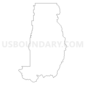
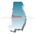
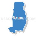
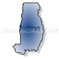
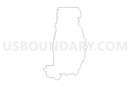
Unpopulated Voting District, Cache County, Utah
About
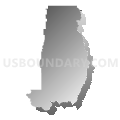
Outline
Summary
| Unique Area Identifier | 678551 |
| Name | Unpopulated Voting District |
| County | Cache County |
| State | Utah |
| Area (square miles) | 710.64 |
| Land Area (square miles) | 710.24 |
| Water Area (square miles) | 0.40 |
| % of Land Area | 99.94 |
| % of Water Area | 0.06 |
| Latitude of the Internal Point | 41.67498160 |
| Longtitude of the Internal Point | -111.64525260 |
Maps

Graphs
Select a template below for downloading or customizing gragh for Unpopulated Voting District, Cache County, Utah


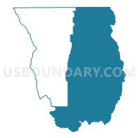
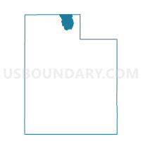
Neighbors
Neighoring Voting District (by Name) Neighboring Voting District on the Map
- Cove Voting District, Cache County, UT
- Fish Haven Voting District, Bear Lake County, ID
- Franklin 10 Voting District, Franklin County, ID
- Garden City Voting District, Rich County, UT
- Huntsville 2A Voting District, Weber County, UT
- Hyde Park 01 Voting District, Cache County, UT
- Hyrum 02B Voting District, Cache County, UT
- Hyrum 05 Voting District, Cache County, UT
- Laketown Voting District, Rich County, UT
- Logan 13 Voting District, Cache County, UT
- Logan 14 Voting District, Cache County, UT
- Logan 21 Voting District, Cache County, UT
- Logan 22 Voting District, Cache County, UT
- Logan 29 Voting District, Cache County, UT
- Mantua Unincorporated Voting District, Box Elder County, UT
- Mapleton 11 Voting District, Franklin County, ID
- Millville 02 Voting District, Cache County, UT
- Nibley 02 Voting District, Cache County, UT
- North Logan 04 Voting District, Cache County, UT
- North Logan 05 Voting District, Cache County, UT
- North Logan 06 Voting District, Cache County, UT
- Paradise Voting District, Cache County, UT
- Providence 01 Voting District, Cache County, UT
- Providence 02 Voting District, Cache County, UT
- Providence 05 Voting District, Cache County, UT
- Randolph North Voting District, Rich County, UT
- Randolph South Voting District, Rich County, UT
- Richmond 01 Voting District, Cache County, UT
- Richmond 02 Voting District, Cache County, UT
- Smithfield 02 Voting District, Cache County, UT
- Smithfield 03 Voting District, Cache County, UT
- Smithfield 04 Voting District, Cache County, UT
- Upper Valley 1 Voting District, Weber County, UT
- Upper Valley 2 Voting District, Weber County, UT
- Upper Valley 3 Voting District, Weber County, UT
- Woodruff Voting District, Rich County, UT
Top 10 Neighboring County Subdivision (by Population) Neighboring County Subdivision on the Map
- Logan CCD, Cache County, UT (78,094)
- Brigham City CCD, Box Elder County, UT (26,864)
- Smithfield CCD, Cache County, UT (12,379)
- Hyrum CCD, Cache County, UT (9,799)
- Preston CCD, Franklin County, ID (9,398)
- Ogden Valley CCD, Weber County, UT (6,604)
- Lewiston CCD, Cache County, UT (6,162)
- Paris CCD, Bear Lake County, ID (1,729)
- Garden City-Laketown CCD, Rich County, UT (1,226)
- Randolph-Woodruff CCD, Rich County, UT (1,038)
Top 10 Neighboring Place (by Population) Neighboring Place on the Map
- Logan city, UT (48,174)
- North Logan city, UT (8,269)
- Hyrum city, UT (7,609)
- Providence city, UT (7,075)
- Millville city, UT (1,829)
- Cove CDP, UT (460)
- Avon CDP, UT (367)
- Garden CDP, UT (181)
Top 10 Neighboring Unified School District (by Population) Neighboring Unified School District on the Map
- Weber School District, UT (148,422)
- Cache School District, UT (64,634)
- Box Elder School District, UT (49,975)
- Logan School District, UT (48,022)
- Preston Joint School District 201, ID (10,253)
- Bear Lake County School District 33, ID (5,835)
- Rich School District, UT (2,264)
Top 10 Neighboring State Legislative District Lower Chamber (by Population) Neighboring State Legislative District Lower Chamber on the Map
- State House District 31, ID (45,173)
- State House District 5, UT (43,319)
- State House District 3, UT (38,268)
- State House District 53, UT (37,757)
- State House District 2, UT (34,283)
- State House District 8, UT (32,064)
- State House District 4, UT (28,046)
Top 10 Neighboring State Legislative District Upper Chamber (by Population) Neighboring State Legislative District Upper Chamber on the Map
- State Senate District 17, UT (102,922)
- State Senate District 19, UT (91,855)
- State Senate District 25, UT (89,262)
- State Senate District 31, ID (45,173)
Top 10 Neighboring 111th Congressional District (by Population) Neighboring 111th Congressional District on the Map
Top 10 Neighboring Census Tract (by Population) Neighboring Census Tract on the Map
- Census Tract 2.02, Cache County, UT (6,953)
- Census Tract 2101, Weber County, UT (6,942)
- Census Tract 9702, Franklin County, ID (6,718)
- Census Tract 11.01, Cache County, UT (5,596)
- Census Tract 12.01, Cache County, UT (4,955)
- Census Tract 1.01, Cache County, UT (4,599)
- Census Tract 7.01, Cache County, UT (4,520)
- Census Tract 11.02, Cache County, UT (4,230)
- Census Tract 9608.01, Box Elder County, UT (4,206)
- Census Tract 14.01, Cache County, UT (4,096)
Top 10 Neighboring 5-Digit ZIP Code Tabulation Area (by Population) Neighboring 5-Digit ZIP Code Tabulation Area on the Map
- 84321, UT (44,074)
- 84341, UT (20,109)
- 84335, UT (11,372)
- 83263, ID (9,258)
- 84319, UT (7,905)
- 84332, UT (7,218)
- 84310, UT (4,111)
- 84333, UT (2,722)
- 84317, UT (2,304)
- 84320, UT (2,237)